
Researchers are taking another look at the Cyclades, an extensive island chain in Greece’s Aegean Sea, to learn more about the ways in which people made use of such landscapes thousands of years before they became world-famous tourist destinations. Using advanced remote-sensing technologies together with archaeological survey, international teams are bringing to light evidence that even today’s uninhabited islands played active roles in human history.
The Cyclades consist of over 200 islands scattered southeast of mainland Greece. Major islands, such as Mykonos and Santorini, are often associated with modern tourism, but archaeological investigation has long demonstrated that the region was also integral to ancient Greek civilization. Well-known sites include the sanctuary of Apollo on Delos and the Bronze Age settlement of Akrotiri, preserved beneath volcanic ash. Recent projects, however, illustrate that human activity within the archipelago was far more extensive and varied than previously supposed.
Within the framework of the Small Cycladic Islands Project, 87 uninhabited islands, many systematically surveyed for the first time, were examined. The principal goal was to determine whether these islands were used in the past, how people interacted with them, and how small islands, coastlines, and maritime routes functioned as part of integrated human environments. The evidence suggests that even rugged or apparently marginal islands attracted repeated human use throughout different periods.
One of the key aspects of the research is that all methods used are non-invasive. It is evident that traditional excavation, though informative, does irreversible damage to the archaeological context. In contrast, techniques such as magnetometry allow the researcher to detect subsurface features from variations in the Earth’s magnetic field. Such variations can indicate the presence of buried stone walls and buildings, traces of human activity, and even natural events that have modified soil properties. Magnetometry had hardly ever been used in the Cyclades before, and has proved to be effective for the identification of sites without their disturbance.
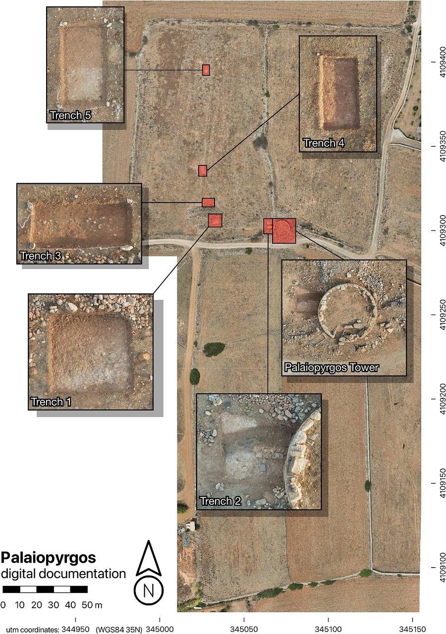
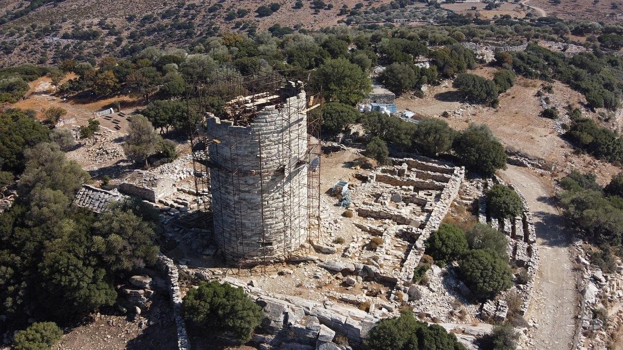
The teams are also using airborne laser scanning, or LIDAR, to map entire islands in high detail. By sending laser pulses from drones or aircraft, LIDAR records surface topography even beneath dense vegetation. Although widely used in other parts of the world, including Mesoamerica and Southeast Asia, its application in Greece is relatively recent. On Cycladic islands such as Naxos, LIDAR has revealed terraces, pathways, fortifications, and settlement patterns that are difficult to recognize from the ground alone.
Put together, these methods allow archaeologists to document landscapes spanning multiple periods. The surveys have identified remains from Bronze Age settlements and classical structures to medieval castles and churches, as well as 19th-century shepherd shelters. Some findings may even indicate Paleolithic activity, pushing the presence of human beings earlier than had been assumed. Especially significant is new evidence for Neolithic habitation, suggesting that small islands were settled earlier and more extensively than scholars had previously believed.

Beyond the academic contribution of the research, it has practical implications, too. By identifying areas of archaeological sensitivity, this project supports heritage protection and more sustainable development in a region where tourism is continuing to expand. Working with the Greek Ministry of Culture has already led to the designation of Polyaigos—the largest uninhabited island in the Aegean—as a protected archaeological zone.
The work also reflects broader changes in archaeology, as digital technologies, machine learning, and computational modeling increasingly shape the study of the past.